Produktbild: Natural Resource Monitoring, Planning and Management Based on Advanced Programming

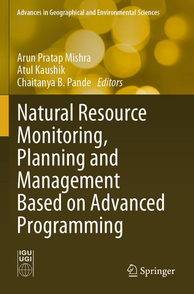
Natural Resource Monitoring, Planning and Management Based on Advanced Programming

175,99 €

inkl. gesetzl. MwSt., Versandkostenfrei


Beschreibung

Produktdetails

Einband

Taschenbuch

Erscheinungsdatum

19.07.2025

Herausgeber

Arun Pratap Mishra + weitere

Verlag

Springer Singapore

Seitenzahl

328

Maße (L/B/H)

23,5/15,5/1,8 cm

Gewicht

578 g

Auflage

1. Auflage

Sprache

Englisch

ISBN

978-981-9728-81-7

Beschreibung

Portrait

Mr. Arun Pratap Mishra holds a postgraduate degree in Environmental Science from Hemwati Nandan Bahuguna Garhwal (Central) University, Uttarakhand, India. He has made valuable contributions to the scientific community through his publications, which include 20 research articles, 10 book chapters, 3 conference papers, and 1 technical report. He has gained valuable professional experience as Project Fellow at esteemed institutions such as Uttarakhand Space Application Centre, Botanical Survey of India, and RBased Services Private Limited. He has also completed a postgraduate diploma in Remote Sensing & Geographic Information Systems (RS&GIS) from the Indian Institute of Remote Sensing (IIRS, ISRO), which has further enhanced his expertise in advanced technologies. Mr. Mishra is currently employed as Project Associate at Wildlife Institute of India, Uttarakhand, where he uses innovative computational techniques to advance ecological research and conservation efforts.

Mr. Atul Kaushik received his M.Sc. in Environmental Science from the Institute of Science, Banaras Hindu University (BHU), Varanasi, and M.Tech. in Remote Sensing & Geographic Information Systems (RS&GIS) from the Indian Institute of Remote Sensing (IIRS), Dehradun. Currently, he is Research Scholar at the Indian Institute of Technology (IIT) Bombay, Mumbai, where his work is focused on multi-temporal and multi-sensor satellite data for studying carbon dynamics in different types of vegetation in India. He has previously worked as Research Staff at Uttarakhand Space Application Centre (USAC), Dehradun, and as Project Associate at the National Institute of Advanced Studies (NIAS), Bengaluru He has been actively involved in the RS&GIS discipline for the past five years, with experience in working with optical, radar as well as LIDAR datasets for mapping and monitoring activities of vegetation and water resources.

Dr. Chaitanya B. Pande completed his Ph.D. in Environmental Science from Sant Gadge Baba Amravati University, Amravati, and M.Sc. in Geo-informatics from Amravati University in 2011.  He is Research Fellow at the International University. His research interests include remote sensing, GIS, Google Earth Engine, machine learning, watershed management, hydrogeology, hydrological modelling, drought monitoring, land use and land cover analysis, groundwater quality, urban planning, hydro-geochemistry, groundwater modelling, geology, hyperspectral remote sensing, remote sensing and GIS application in natural resources management, watershed management and environmental monitoring and assessment subjects. He has more than 12 years of teaching, research, and industrial experience. So far, he has published above 120+ international and national research papers, 3 textbooks, 15+ edited books, 19 conference papers, and 30 book chapters in Scopus index. He also acts as a reviewer for several scientific international journals and editorial board member in American Journal of Agricultural and Biological Sciences .

Produktdetails

Einband

Taschenbuch

Erscheinungsdatum

19.07.2025

Herausgeber

Verlag

Springer Singapore

Seitenzahl

328

Maße (L/B/H)

23,5/15,5/1,8 cm

Gewicht

578 g

Auflage

1. Auflage

Sprache

Englisch

ISBN

978-981-9728-81-7

Herstelleradresse

Springer-Verlag KG
Sachsenplatz 4-6
1201 Wien
AT

Email: GPSR Kontakt

Ein neues Kapitel für Ihre Bücher

Ein neues Kapitel für Ihre Bücher

Schenken Sie Ihren alten Schätzen ein zweites Leben und erhalten dafür eine Thalia Geschenkkarte.

Jetzt verkaufen
Jetzt verkaufen

Noch keine Bewertungen vorhanden

Verfassen Sie die erste Bewertung zu diesem Artikel

Helfen Sie anderen Kundinnen und Kunden durch Ihre Meinung.

Kundinnen und Kunden meinen

Bewertungen (0)

  • Produktbild: Natural Resource Monitoring, Planning and Management Based on Advanced Programming
  • Introduction.- A Geographical Investigation of the Rishiganga Disaster in Uttarakhand, India.- Multi-temporal analysis of vegetation extent using Google Earth Engine.- Spatial Prediction Modelling of Landslide Susceptibility Assessment Using Statistical Information Value Model-A Case Study of Dharchula, Pithoragarh District Uttarakhand, India.- Spatiotemporal change analysis of urbanization in Gurugram District of Haryana, India using a geospatial technique.- Rapid assessment of flood inundation due to tropical cyclones in part of Sundarbans in Google Earth Engine environment.- Random Tree Classifier for Land Use Classification in Hilly Terrain Using Sentinel-2 Imagery: A Case Study of Almora Town, Uttarakhand, India.- Temporal Investigation of Chlorophyll-a in the Bhimgoda Barrage and Wetland Landscape Using Remote Sensing and GIS.- People's perception-based identification of climate change risks faced by the smallholder community of the western Indian Himalayan region.- Development of a new built-up index: Studying the impact of tree and building height variation on Urban thermal field variance index.- Spectroscopy and Machine Learning: Revolutionizing Soil Quality Monitoring for Sustainable Resource Management.- Quantification of sedimentation of a tropical reservoir through satellite altimetry: A case study of Maithon reservoir.- Conclusion.