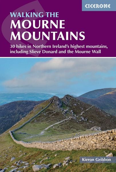
Walking the Mourne Mountains 30 hikes in Northern Ireland's highest mountains, including Slieve Donard and the Mourne Wall
-
- Englisch ausgewählt
18,99 €
inkl. gesetzl. MwSt.,
Beschreibung
Produktdetails
Einband
Taschenbuch
Erscheinungsdatum
15.10.2026
Verlag
Cicerone Press LimitedSeitenzahl
256
Maße (L/B)
17,2/11,6 cm
Sprache
Englisch
ISBN
978-1-78631-262-4
Walking the Mourne Mountains covers one of the finest hill-walking destinations in Ireland — a compact granite range rising steeply from the Irish Sea coast of County Down, Northern Ireland. This definitive guide presents 30 primary routes and over 70 variations, graded Easy to Very Hard, taking in all 14 mountain summits including Slieve Donard (850m), the highest point in Northern Ireland and Ulster, and many smaller hills.
Routes are organised into four sections — Eastern Mournes, Western Mournes, the Mourne Wall, and the Mourne Ultra — ranging from gentle forest rambles and valley circuits to challenging high-level horseshoe ridge walks. Every route features accurate GPX-measured distances and ascent figures, with indicative times calculated to Naismith’s Rule. Highlights include the famous 32km (19.5-mile) Mourne Wall Challenge and the newly-created Mourne Ultra: a set of five interconnected single-day loops covering the full challenge route across the range.
The Mournes are among Ireland’s most accessible upland areas, just 50km south of Belfast and 120km from Dublin, with regular bus services to the main gateway town of Newcastle. A summer Mourne Rambler bus links key trailheads for walkers without cars. Abundant accommodation — from hotels and B&Bs to glamping and camping — in Newcastle, Rostrevor, Kilkeel and the surrounding area makes the Mournes equally well suited to a day walk or a full walking holiday.
- 30 primary routes and 70+ variations providing 100+ unique walks, graded Easy, Moderate, Hard and Very Hard
- All 14 Mourne Hewitt summits covered, including Slieve Donard (850m), the highest point in Northern Ireland
- Includes the Mourne Wall Challenge (19.5 miles) and the newly-created Mourne Ultra — five interconnected loops traversing the full range
- GPX files available to download; fully integrated with the Cicerone app for offline GPS navigation
- Recommended maps: Harvey Maps 1:25k Superwalker, OSNI 1:50k Discoverer Sheet 29, OSNI 1:25k Activity Series
- Practical planning chapters on transport, parking, seasonal conditions, accommodation and access across the range
- Many routes connect to the Mourne Way waymarked trail
Whether you are planning your first day in the hills or a multi-day hillwalking holiday, Walking the Mourne Mountains is the most comprehensive guide ever published for the range — giving you everything you need to explore Northern Ireland’s finest mountains with confidence. Pick up your copy, download your GPX tracks, and head for the hills.
Ein neues Kapitel für Ihre Bücher
Ein neues Kapitel für Ihre Bücher
Schenken Sie Ihren alten Schätzen ein zweites Leben: Einfach Barcode scannen, Versandetikett ausdrucken, Bücher verschicken und Thalia Geschenkkarte erhalten.
Jetzt verkaufenNoch keine Bewertungen vorhanden
Verfassen Sie die erste Bewertung zu diesem Artikel
Helfen Sie anderen Kundinnen und Kunden durch Ihre Meinung.
Kurze Frage zu unserer Seite
Vielen Dank für Ihr Feedback
Wir nutzen Ihr Feedback, um unsere Produktseiten zu verbessern. Bitte haben Sie Verständnis, dass wir Ihnen keine Rückmeldung geben können. Falls Sie Kontakt mit uns aufnehmen möchten, können Sie sich aber gerne an unseren Kund*innenservice wenden.
zum Kundenservice