
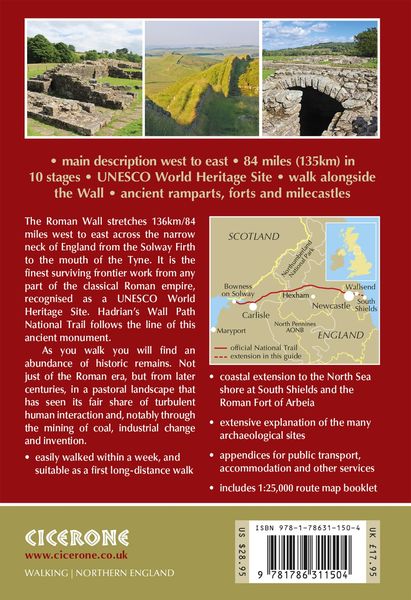
Hadrian's Wall Path National Trail: Described west-east and east-west
-
- Taschenbuch ausgewählt
- eBook
-
Sprache:Englisch
21,99 €
UVP
27,90 €
inkl. gesetzl. MwSt.,
Beschreibung
Produktdetails
Einband
Taschenbuch
Erscheinungsdatum
12.10.2023
Abbildungen
107 photographs 16 route maps 2 public transport maps
Verlag
Cicerone Press LimitedSeitenzahl
240
Maße (L/B/H)
17,4/11,3/2 cm
Gewicht
310 g
Auflage
4th edition
Sprache
Englisch
ISBN
978-1-78631-150-4
Warnhinweis
Dieser Hinweis kann lt. Artikel 9 Absatz 7 Satz 2 der GPSR entfallen, da das Produkt auch ohne Anweisungen und Sicherheitsinformationen sicher und wie vom Hersteller vorgesehen verwendet werden kann.
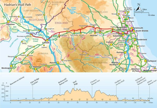
Walk through history on the Hadrian’s Wall Path, a remarkable 135km (84-mile) National Trail following the line of the ancient Roman frontier across northern England, from Bowness-on-Solway in Cumbria to Wallsend, Newcastle. Accessible to first-time long-distance walkers yet equally rewarding for seasoned hikers, the trail winds through rolling farmland, wild moorland, and remarkable Roman sites, including ancient forts, milecastles, and exposed stretches of the Wall itself.
Designed to help you get the most from every mile, this Cicerone guidebook features detailed route descriptions covering the entire trail in both directions, west to east or east to west, plus an optional extension to South Shields to complete the coast-to-coast. An accompanying OS 1:25,000 map booklet, with full route line clearly marked, enables easy and accurate navigation throughout your journey.
- The route is divided into 10 manageable stages, each supported by detailed mapping, distance information and route description, so you're always prepared for what lies ahead on Hadrian's Wall
- Practical planning information, such as accommodation listings in key centres like Carlisle, Newton and Hexham, alternative walking schedules and route options, helps you adapt the walk to your own pace
- Public transport options are listed for every stage, including trail diversions to Haltwhistle, Bardon Mill and Corbridge stations, making it easy for section hikers to devise an itinerary that suits their needs
- Downloadable GPX files provide a simple digital navigation option for use on smartphone apps
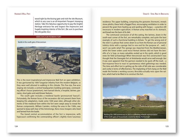
- Alongside navigation, the guide enriches your journey with authoritative context on world-class archaeological sites, including Birdoswald, Housesteads, Vindolanda, and the dramatic crags of Steel Rigg, helping you understand the significance of this historic landscape as you walk
The Hadrian’s Wall Path invites a quieter kind of adventure — one of steady footsteps, open views, and moments of connection with the landscape’s long history. With this guidebook, you can explore Britain's Roman frontier at your own pace, supported by clear guidance and a complete set of navigational tools.
Ein neues Kapitel für Ihre Bücher
Ein neues Kapitel für Ihre Bücher
Schenken Sie Ihren alten Schätzen ein zweites Leben und erhalten Sie dafür eine Thalia Geschenkkarte.
Noch keine Bewertungen vorhanden
Verfassen Sie die erste Bewertung zu diesem Artikel
Helfen Sie anderen Kundinnen und Kunden durch Ihre Meinung.
Kurze Frage zu unserer Seite
Vielen Dank für Ihr Feedback
Wir nutzen Ihr Feedback, um unsere Produktseiten zu verbessern. Bitte haben Sie Verständnis, dass wir Ihnen keine Rückmeldung geben können. Falls Sie Kontakt mit uns aufnehmen möchten, können Sie sich aber gerne an unseren Kund*innenservice wenden.
zum Kundenservice