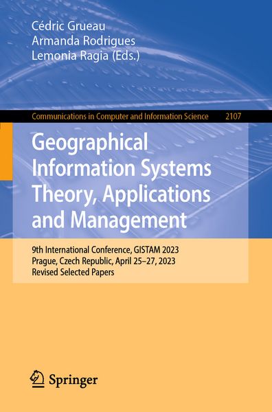
Geographical Information Systems Theory, Applications and Management 9th International Conference, GISTAM 2023, Prague, Czech Republic, April 25–27, 2023, Revised Selected Papers
-
- Taschenbuch ausgewählt
- eBook
-
Sprache:Englisch
-
Auflage:2024
57,99 €
UVP
106,99 €
inkl. gesetzl. MwSt.,
Beschreibung
Produktdetails
Einband
Taschenbuch
Erscheinungsdatum
01.05.2024
Abbildungen
IX, 115 p. 59 illus., 47 illus. in color.
Herausgeber
Cédric Grueau + weitereVerlag
SpringerSeitenzahl
115
Maße (L/B/H)
23,5/15,5/0,8 cm
Gewicht
207 g
Auflage
2024
Sprache
Englisch
ISBN
978-3-031-60276-4
This book constitutes the refereed post-proceedings of the 9th International Conference on Geographical Information Systems Theory, Applications and Management, GISTAM 2023, held in Prague, Czech Republic during April 25–27, 2023.
The 6 full papers included in this book were carefully reviewed and selected from 37 submissions. They focus on challenges in geo-spatial data sensing, observation, representation, processing, visualization, sharing and managing, in all aspects concerning both information communication and technologies (ICT) as well as management information systems and knowledge-based systems.
Ein neues Kapitel für Ihre Bücher
Ein neues Kapitel für Ihre Bücher
Schenken Sie Ihren alten Schätzen ein zweites Leben und erhalten Sie dafür eine Thalia Geschenkkarte.
Noch keine Bewertungen vorhanden
Verfassen Sie die erste Bewertung zu diesem Artikel
Helfen Sie anderen Kundinnen und Kunden durch Ihre Meinung.
Kurze Frage zu unserer Seite
Vielen Dank für Ihr Feedback
Wir nutzen Ihr Feedback, um unsere Produktseiten zu verbessern. Bitte haben Sie Verständnis, dass wir Ihnen keine Rückmeldung geben können. Falls Sie Kontakt mit uns aufnehmen möchten, können Sie sich aber gerne an unseren Kund*innenservice wenden.
zum Kundenservice