















































KI-Beratung Beta

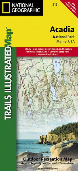
Produktbild: Acadia National Park Map
- 16%

Acadia National Park Map

16% sparen

14,99 € UVP 17,95 €

inkl. gesetzl. MwSt., Versandkostenfrei


Beschreibung

This Trails Illustrated topographic map is the most comprehensive recreational map for Acadia National Park, located along the beautiful Atlantic coast in Maine. Updated to reflect road closings, new trails, and campground relocation; it also includes detailed trail information, points of interest, trailheads,...

Beschreibung

This Trails Illustrated topographic map is the most comprehensive recreational map for Acadia National Park, located along the beautiful Atlantic coast in Maine. Updated to reflect road closings, new trails, and campground relocation; it also includes detailed trail information, points of interest, trailheads, picnic areas, facilities, and more. Features sites such as Mount Desert Island, Sestern Mountain, Norwood Ridge, Freeman Ridge, Isle au Haut, Marshall Island, Swans Island, Western Bay, Mount Desert Narrows, Frenchman Bay, Eastern Way, Echo Lake, and more.

Produktdetails

Einband

Karte

Erscheinungsdatum

01.06.2009

Verlag National geographic
Seitenzahl

2

Produktdetails

Einband

Karte

Erscheinungsdatum

01.06.2009

Verlag National geographic
Seitenzahl

2

Maße (L/B/H)

24/11,6/1 cm

Gewicht

92 g

Auflage

2019th edition

Sprache

Englisch

ISBN

978-1-56695-352-8

Herstelleradresse

Libri GmbH
Europaallee 1
36244 Bad Hersfeld
DE

Email: gpsr@libri.de

Ein neues Kapitel für Ihre Bücher

Ein neues Kapitel für Ihre Bücher

Schenken Sie Ihren alten Schätzen ein zweites Leben und erhalten Sie dafür eine Thalia Geschenkkarte.

Jetzt verkaufen
Jetzt verkaufen

Noch keine Bewertungen vorhanden

Verfassen Sie die erste Bewertung zu diesem Artikel

Helfen Sie anderen Kundinnen und Kunden durch Ihre Meinung.

Kundinnen und Kunden meinen

Bewertungen (0)

Weitere Artikel finden Sie in

  • Produktbild: Acadia National Park Map