















































KI-Beratung Beta

Gutscheinbedingungen

Gültig bis 11.11.2026 | Gültig für Spielzeug, Filme, Musik, Software, Games, Geschenke & Trends, Schreibwaren, Hörbücher und Hörbuch-Downloads (außer Abo & Shelfies), gebrauchte Bücher, nicht preisgebundene Bücher und Kalender | Einlösbar unter thalia.de und in der Thalia App | Click & Collect nur mit Online-Zahlung (Paypal/Kreditkarte) vorab | Einzelne Artikel können ausgeschlossen sein | Nicht kombinierbar mit anderen Gutscheinen oder Preisaktionen | Nur einmal pro Einkauf einlösbar | Gutschein wird auf max. 500€ Bestellwert angerechnet | Keine Barauszahlung | Digitale Hörbücher nur für Android  | Nicht gültig für preisgebundene Artikel (aufgrund der Buchpreisbindung sind Gutscheine nicht auf Bücher, eBooks, Presse einlösbar), tolino eReader & Zubehör, Abonnements & Flatrates, Geschenkkarten, Versandkosten und Services

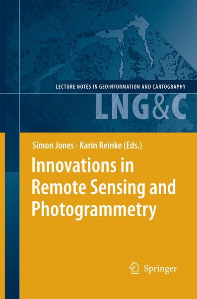
  • Produktbild: Innovations in Remote Sensing and Photogrammetry
  • Produktbild: Innovations in Remote Sensing and Photogrammetry

Innovations in Remote Sensing and Photogrammetry

146,99 €

inkl. gesetzl. MwSt., Versandkostenfrei


Beschreibung

Produktdetails

Einband

Taschenbuch

Erscheinungsdatum

14.03.2012

Abbildungen

XXXII, 468 p. 218 illus., 3 illus. in color.

Herausgeber

Simon Jones + weitere

Verlag

Springer Berlin

Seitenzahl

468

Maße (L/B/H)

23,5/15,5/2,7 cm

Gewicht

750 g

Auflage

2009

Sprache

Englisch

ISBN

978-3-642-26127-5

Beschreibung

Produktdetails

Einband

Taschenbuch

Erscheinungsdatum

14.03.2012

Abbildungen

XXXII, 468 p. 218 illus., 3 illus. in color.

Herausgeber

Verlag

Springer Berlin

Seitenzahl

468

Maße (L/B/H)

23,5/15,5/2,7 cm

Gewicht

750 g

Auflage

2009

Sprache

Englisch

ISBN

978-3-642-26127-5

Herstelleradresse

Springer-Verlag KG
Sachsenplatz 4-6
1201 Wien
AT

Email: ProductSafety@springernature.com

Ein neues Kapitel für Ihre Bücher

Ein neues Kapitel für Ihre Bücher

Schenken Sie Ihren alten Schätzen ein zweites Leben und erhalten Sie dafür eine Thalia Geschenkkarte.

Jetzt verkaufen
Jetzt verkaufen

Noch keine Bewertungen vorhanden

Verfassen Sie die erste Bewertung zu diesem Artikel

Helfen Sie anderen Kundinnen und Kunden durch Ihre Meinung.

Kundinnen und Kunden meinen

Bewertungen (0)

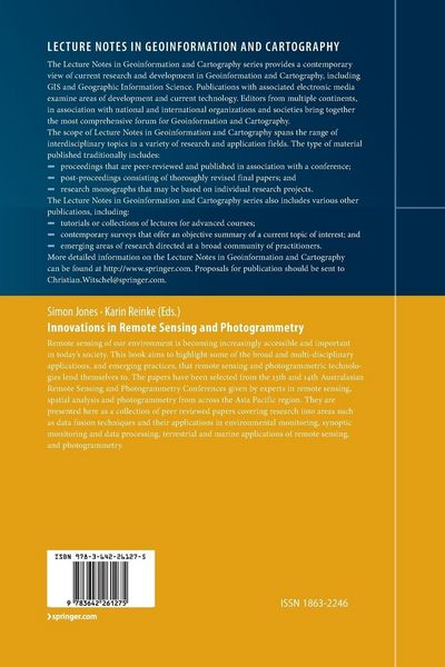
  • Produktbild: Innovations in Remote Sensing and Photogrammetry
  • Produktbild: Innovations in Remote Sensing and Photogrammetry
  • Data fusion techniques and their applications in environmental monitoring.- A Comparison of Pixel- and Object-Level Data Fusion Using Lidar and High-Resolution Imagery for Enhanced Classification.- Combining Texture and Hyperspectral Information for the Classification of Tree Species in Australian Savanna Woodlands.- High-Resolution Satellite Imaging in Remote Regions: A Case Study in Bhutan.- A New Dataset for Forest Height Across Australia: Pilot Project to Calibrate ICESat Laser Data with Airborne LiDAR.- Linking Biological Survey Information to Remote Sensing Datasets: A Case Study.- Synoptic monitoring and data processing.- Characterizing the Landsat Global Long-Term Data Record.- Evaluation of Alternative Sensors for a Landsat-Based Monitoring Program.- Evaluation of CBERS Image Data: Geometric and Radiometric Aspects.- Mapping and Monitoring Wetlands Around the World Using ALOS PALSAR: The ALOS Kyoto and Carbon Initiative Wetlands Products.- Testing of Alternate Classification Procedures Within an Operational, Satellite Based, Forest Monitoring System.- An Investigation of the Remote Sensing of Aerosols Based on MODIS Data for Western Australian Conditions.- Improved Near-Real Time Atmospheric Correction of MODIS Data for Earth Observation Applications.- Near-Real Time Satellite Products to Drive Australia-Wide Land Surface Monitoring and Modelling of Surface Water and Energy Balance.- Recent and Future Developments in Meteorological Remote Sensing.- Improved Spatial Resolution of Fire Detection with MODIS Using the 2.1??m Channel.- Terrestrial applications of remote sensing.- Characterizing Eucalypt Leaf Phenology and Stress with Spectral Analysis.- Development of Satellite Vegetation Indices to Assess Grassland Curing Across Australia and New Zealand.-Assessment of Grassland Curing Using Field-Based Spectrometry and Satellite Imagery.- Airborne Fire Intelligence.- Give Me the Dirt: Detection of Gully Extent and Volume Using High-Resolution Lidar.- Integrating Mineralogical Interpretation of HyLogger Data with HyMap Mineral Mapping, Mount Painter, South Australia.- A Preliminary Study of Mapping Biomass and Cover in NZ Grasslands Using Multispectral Narrow-Band Data.- Comparing Common Hyperspectral Vegetation Indices for Their Ability to Estimate Seasonal Nitrogen and Other Variables in Winter Wheat Across a Growing Season.- The Spectral Response of Pastures in an Intensively Managed Dairy System.- Using Pasture Growth Rate Data in a National Agricultural Drought Assessment Monitoring Tool.- Investigating the Potential for Mapping Fallow Management Practises Using MODIS Image Data.- Spectral Mixture Analysis for Ground-Cover Mapping.- Vineclipper: A Proximal Search Algorithm to Tie Gps Field Locations to High Resolution Grapevine Imagery.- Modelling Weed Distribution Across the Northern Australia Using Very Extensive Transects.- Automated Reconstruction of Buildings Using a Hand Held Video Camera.- Marine applications of remote sensing.- Mapping Seagrass Biomass with Photo-Library Method.- A Comparison of Bathymetric Signatures Observed on ERS SAR and LANDSAT TM Images Over the Timor Sea.- Optical Properties of Water Bodies in the Torres Strait, Australia, from Above-Water Reflectance.- Accordance of MERIS Standard Products over the Gulf of Finland to the Parameters Measured Under Regular Monitoring Program.- Spectral Identification of Oil Slicks on the Ocean.