















































KI-Beratung Beta

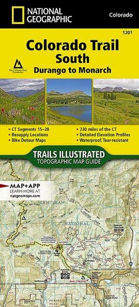
Produktbild: Colorado Trail South, Durango to Monarch Map
Band 1201

Colorado Trail South, Durango to Monarch Map

14,99 €

inkl. gesetzl. MwSt., Versandkostenfrei


Beschreibung

- Waterproof - Tear-Resistant - Topographic Map

The Colorado Trail, South Topographic Map Guide has been designed as the perfect traveling companion when navigating the southern section of The Colorado Trail. In a state known for its trails, The Colorado Trail is Colorado's premier long distance trail....

Beschreibung

- Waterproof - Tear-Resistant - Topographic Map

The Colorado Trail, South Topographic Map Guide has been designed as the perfect traveling companion when navigating the southern section of The Colorado Trail. In a state known for its trails, The Colorado Trail is Colorado's premier long distance trail.

  • Conceived in 1973 and completed in 1987, the trail runs 486 miles between Denver and Durango, traversing some of the most spectacular scenery in the state.
  • When The Colorado Trail is traversed from its southern terminus outside of Durango it climbs steeply into the San Juan Mountains where it stays above 10,000 feet for almost 150 miles with only a single steep decent to the Animas River near Silverton.
  • The highest point on the trail is found in the San Juan Mountains at 13,271 feet.
  • After leaving the San Juan Mountains, the trail travels for a short time below 10,000 feet before once again climbing into the Sawatch Range and joining The Colorado Trail North and Collegiate Loop.
  • Each page is centered on the trail and overlaps with adjacent pages so there is little chance of getting lost.
  • Along the bottom of each page is a trail profile that shows the distance between passes, camping areas, and trail access points.

The map and trail profile provide a step by step visual guide to hiking the trail, mile by rugged mile. Expertly researched and created in partnership with local land management agencies including The Colorado Trail Foundation, this map guide provides detailed topographic maps, interesting history, bike detour maps, and a resupply location chart shows distances, and services available at each resupply point.

More convenient and easier to use than folded maps, but just as compact and lightweight, National Geographic's Topographic Map Guide booklets are printed on "Backcountry Tough" waterproof, tear-resistant paper with stainless steel staples. A full UTM grid is printed on the map to aid with GPS navigation.

Other features found on this map include: Cochetopa Hills, Durango, Garfield, Hesperus Mountain, Hinsdale County, La Garita Mountains, La Plata County, La Plata Mountains, Lake City, Monarch Pass, San Juan County, San Luis Peak, Sargents, Sharkstooth Peak, Silverton, Trimble.

  • Map Scale = 1:75,000
  • Folded Size = 4.25" x 9.38"

Produktdetails

Einband

Karte

Erscheinungsdatum

25.07.2017

Verlag National geographic
Seitenzahl

44

Produktdetails

Einband

Karte

Erscheinungsdatum

25.07.2017

Verlag National geographic
Seitenzahl

44

Maße (L/B/H)

23,7/11,1/0,8 cm

Gewicht

91 g

Auflage

2018th edition

Sprache

Englisch

ISBN

978-1-56695-694-9

Herstelleradresse

Libri GmbH
Europaallee 1
36244 Bad Hersfeld
DE

Email: gpsr@libri.de

Ein neues Kapitel für Ihre Bücher

Ein neues Kapitel für Ihre Bücher

Schenken Sie Ihren alten Schätzen ein zweites Leben und erhalten Sie dafür eine Thalia Geschenkkarte.

Jetzt verkaufen
Jetzt verkaufen

Noch keine Bewertungen vorhanden

Verfassen Sie die erste Bewertung zu diesem Artikel

Helfen Sie anderen Kundinnen und Kunden durch Ihre Meinung.

Kundinnen und Kunden meinen

Bewertungen (0)

Weitere Artikel finden Sie in

  • Produktbild: Colorado Trail South, Durango to Monarch Map