















































KI-Beratung Beta

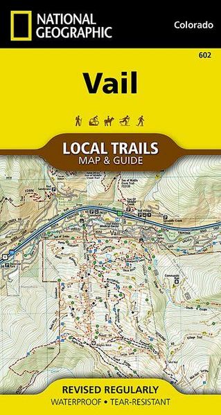
Produktbild: Vail Map [Local Trails]

Vail Map [Local Trails]

11,99 €

inkl. gesetzl. MwSt., Versandkostenfrei


Beschreibung

- Waterproof - Tear-Resistant - Topographic Map

Situated at 8,150 feet in the upper reaches of the Gore Valley and encircled by the White River National Forest, Vail combines one of the world's best alpine ski resorts with a friendly community that maintains its small-town feel. Visitors from around...

Beschreibung

- Waterproof - Tear-Resistant - Topographic Map

Situated at 8,150 feet in the upper reaches of the Gore Valley and encircled by the White River National Forest, Vail combines one of the world's best alpine ski resorts with a friendly community that maintains its small-town feel. Visitors from around the world can find varied shops and restaurants, luxurious accommodations, bountiful cultural events, and year-round recreational opportunities--from hiking to skiing to biking.

  • With so many outdoor recreation options, visitors to Vail have an enviable problem, where should they start?
  • This map is a combination of a standard trail map on the front with a helpful guide on the back that has a selection of recommended hikes, from the moderate 2.9 mile Berrypicker to the strenuous 3,100 foot climb up to Pitkin Lake.
  • Each selected trail includes a brief description, specs such as elevation gain and length as well as a detailed elevation profile to track your progress up and down the numerous peaks and valleys.
  • Each Local Trails map includes detailed trail maps at 1 inch = 1/2 mile.

At this scale every turn of the trail is clearly visible and when covering steep terrain the contours are clearly visible. In addition to the standard features like trailheads and parking areas the maps also show difficulties for each trail segment so you can tell if the entire trail is moderate or if there is only a single short section of difficult on an otherwise easy trail.

Every Local Trails map is printed on "Backcountry Tough" waterproof, tear-resistant paper. A full UTM grid is printed on the map to aid with GPS navigation.

  • Map Scale = 1:31,680
  • Sheet Size = 26.25" x 19.5"
  • Folded Size = 4" x 7.5"

Produktdetails

Einband

Karte

Erscheinungsdatum

09.04.2018

Verlag National geographic
Seitenzahl

2

Produktdetails

Einband

Karte

Erscheinungsdatum

09.04.2018

Verlag National geographic
Seitenzahl

2

Maße (L/B/H)

18,5/9,7/0,5 cm

Gewicht

91 g

Auflage

2018th edition

Sprache

Englisch

ISBN

978-1-56695-754-0

Herstelleradresse

Libri GmbH
Europaallee 1
36244 Bad Hersfeld
DE

Email: gpsr@libri.de

Ein neues Kapitel für Ihre Bücher

Ein neues Kapitel für Ihre Bücher

Schenken Sie Ihren alten Schätzen ein zweites Leben und erhalten Sie dafür eine Thalia Geschenkkarte.

Jetzt verkaufen
Jetzt verkaufen

Noch keine Bewertungen vorhanden

Verfassen Sie die erste Bewertung zu diesem Artikel

Helfen Sie anderen Kundinnen und Kunden durch Ihre Meinung.

Kundinnen und Kunden meinen

Bewertungen (0)

  • Produktbild: Vail Map [Local Trails]