














































Mapping the World at the Dawn of the British Empire A Traveller's Guide
31,99 €
inkl. gesetzl. MwSt.,
Beschreibung
Produktdetails
Einband
Gebundene Ausgabe
Erscheinungsdatum
17.07.2025
Abbildungen
35 Illustrations
Verlag
Oxford AcademicSeitenzahl
240
Maße (L/B/H)
16,4/24,2/2 cm
Gewicht
538 g
Sprache
Englisch
ISBN
978-0-19-894251-1
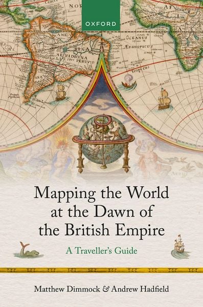
Mapping the World at the Dawn of the British Empire is a compact and informative guide to the ways in which the world was understood and imagined by British travellers and readers in the Tudor and Jacobean period, just before the rapid expansion of the transoceanic British Empire from the mid-seventeenth century onwards. The book shows how the relatively restricted English-speaking world understood different people and places, sometimes through direct encounters, more often through descriptions and travel narratives. The book covers British perceptions of the diverse cultures of the world known to them in the early seventeenth century, from Paris to the South Sea Islands; from the earliest precarious colonies established in the Americas to the mighty Ottoman and Chinese empires; from the frozen north as sailors vainly sought to open up new trade routes by discovering the north-west or north-east passages, to the arid deserts of the Sahara; from the rich fishing grounds of the Baltic and the North Atlantic to the mythical kingdom of Prester John, the fabled golden city of El Dorado and the hidden societies of the dangerous women warriors, the Amazons. The book shows that British readers encountered a vision of the world that simultaneously represented them as specially selected white Christians, superior to other peoples, but also reminded them how dependent they were on other peoples, whose territories produced such vast riches. Reading these accounts of travel, trade, and colonialism demonstrates that English speakers realized how much they had to learn if their nations were to survive and flourish, as well as the possibilities for accumulating wealth through trade and conquest. The book is divided into six chapters, each prefaced by a contemporary map: Europe, The North, Islamic West Asia and the Eastern Mediterranean, East Asia and the South Seas, Africa, and The Americas. There is an introduction, a conclusion, a bibliographical essay, and a guide explaining how to use the book. There are also 35 illustrations, comprising of maps, portraits, and images of relevant objects discussed in the text.
Ein neues Kapitel für Ihre Bücher
Ein neues Kapitel für Ihre Bücher
Schenken Sie Ihren alten Schätzen ein zweites Leben und erhalten Sie dafür eine Thalia Geschenkkarte.
Noch keine Bewertungen vorhanden
Verfassen Sie die erste Bewertung zu diesem Artikel
Helfen Sie anderen Kundinnen und Kunden durch Ihre Meinung.
Kurze Frage zu unserer Seite
Vielen Dank für Ihr Feedback
Wir nutzen Ihr Feedback, um unsere Produktseiten zu verbessern. Bitte haben Sie Verständnis, dass wir Ihnen keine Rückmeldung geben können. Falls Sie Kontakt mit uns aufnehmen möchten, können Sie sich aber gerne an unseren Kund*innenservice wenden.
zum Kundenservice