











































KI-Beratung Beta

Gutscheinbedingungen

Gültig bis 11.11.2026 | Gültig für Spielzeug, Filme, Musik, Software, Games, Geschenke & Trends, Schreibwaren, Hörbücher und Hörbuch-Downloads (außer Abo & Shelfies), gebrauchte Bücher, nicht preisgebundene Bücher und Kalender | Einlösbar unter thalia.de und in der Thalia App | Click & Collect nur mit Online-Zahlung (Paypal/Kreditkarte) vorab | Einzelne Artikel können ausgeschlossen sein | Nicht kombinierbar mit anderen Gutscheinen oder Preisaktionen | Nur einmal pro Einkauf einlösbar | Gutschein wird auf max. 500€ Bestellwert angerechnet | Keine Barauszahlung | Digitale Hörbücher nur für Android  | Nicht gültig für preisgebundene Artikel (aufgrund der Buchpreisbindung sind Gutscheine nicht auf Bücher, eBooks, Presse einlösbar), tolino eReader & Zubehör, Abonnements & Flatrates, Geschenkkarten, Versandkosten und Services

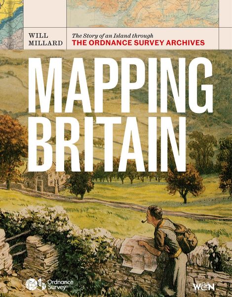
Produktbild: Mapping Britain

Mapping Britain The Story of an Island through the Ordnance Survey Archives

45,99 €

inkl. gesetzl. MwSt., Versandkostenfrei


Beschreibung

Discover the story of Britain as you've never seen it before through the extraordinary archive of Ordnance Survey.

Ordnance Survey has been the home of British mapmaking since 1745, when a twenty-one-year old engineer was first tasked with a small-scale military survey of Scotland. Since then, its maps...

Beschreibung

Discover the story of Britain as you've never seen it before through the extraordinary archive of Ordnance Survey.

Ordnance Survey has been the home of British mapmaking since 1745, when a twenty-one-year old engineer was first tasked with a small-scale military survey of Scotland. Since then, its maps have borne witness to nearly three centuries of phenomenal transformation, from the British Empire to the Industrial Revolution, World War I to the digital era, and are still trusted and treasured by millions of us today.

In Mapping Britain, Will Millard brings the illustrious Ordnance Survey archive to life in a fully-illustrated story of Britain that explores what these maps can tell us about where, why and how we have moved around this island over the centuries. We find disappearing villages, secretive smuggling paths, top-secret military plans and even the detailed maps of Buckingham Palace gifted to Queen Victoria on her fiftieth jubilee.

Rich, rewarding and endlessly fascinating, Mapping Britain is an unmissable record of how our landscape has changed - and how it might do so in the future.

Please note: the maps reproduced in this book are presented as historical and illustrative material within the narrative. They are not intended to function as detailed reference maps, and some labels and cartographic details may appear at a reduced size.

Produktdetails

Einband

Gebundene Ausgabe

Erscheinungsdatum

01.10.2026

Abbildungen

Full colour maps throughout

Verlag Weidenfeld and Nicolson

Produktdetails

Einband

Gebundene Ausgabe

Erscheinungsdatum

01.10.2026

Abbildungen

Full colour maps throughout

Verlag Weidenfeld and Nicolson
Seitenzahl

256

Maße (L/B/H)

24,5/19,1/2,8 cm

Gewicht

1032 g

Sprache

Englisch

ISBN

978-1-399-62584-5

Herstelleradresse

Libri GmbH
Europaallee 1
36244 Bad Hersfeld
DE

Email: gpsr@libri.de

Ein neues Kapitel für Ihre Bücher

Ein neues Kapitel für Ihre Bücher

Schenken Sie Ihren alten Schätzen ein zweites Leben und erhalten Sie dafür eine Thalia Geschenkkarte.

Jetzt verkaufen
Jetzt verkaufen

Noch keine Bewertungen vorhanden

Verfassen Sie die erste Bewertung zu diesem Artikel

Helfen Sie anderen Kundinnen und Kunden durch Ihre Meinung.

Kundinnen und Kunden meinen

Bewertungen (0)

Die Leseprobe wird geladen.
  • Produktbild: Mapping Britain